Part One: 1820s-1830s, The Early Years
By John Hendricks, historian
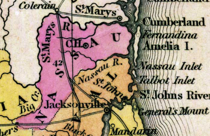
The origin of the name “Nassau” begins during Florida’s British Period in the late 1700s. The English named the river between the St. Marys and St Johns after the Duchy of Nassau in Germany and the area to its north gained the same name. After the Revolutionary War ended in 1783, East Florida went back to Spain. The river kept the name Nassau, but the area became known as the Upper St. Marys District. By 1800, Spain found it increasing difficult to rule and protect Florida. Realizing that they little to gain by holding on to this nearly empty possession, in 1819 Spain signed the Adams-Onis Treaty with the US. After nearly two years of little action, the US Congress finally ratified the agreement. On March 30, 1821, the new American territory of Florida was born. The sparsely populated territory was divided into two large counties: St Johns and Escambia, with the boundary line being the Suwanee River. To determine the new territorial capital, men riding horseback left the two county seats (St. Augustine and Pensacola) and headed toward each other, meeting just south of where the new capital town of Tallahassee was founded. Only about 1200 pioneers lived in the area south of the St Marys River with most living on or near the river on Amelia Island. These citizens fell under the jurisdiction of St. Johns County and had to travel either by the Kings Road or sail south to St. Augustine to take care of legal business.
Thirteen months later, in August of 1822, Jackson and Duval Counties were carved out of Escambia and St Johns, respectively. Land records of what little settlers lived the Upper St Marys district were moved from St. Augustine to Jacksonville, formerly known as the sleepy river crossing of Cowford. Two more counties were formed (Gadsden and Monroe) before December 9, 1824, when five more counties were carved out of the existing six: Walton and Leon out of Escambia/Jackson, Mosquito out of St. Johns and Alachua and Nassau out of Duval. After 28 months of being controlled by Jacksonville, our ancestors living here in the new county called Nassau chanted the Duuuuvaall cheer no longer. There were many sudden changes that the 1200 citizens of Nassau experienced within this short 5-year period between 1819 and 1824.
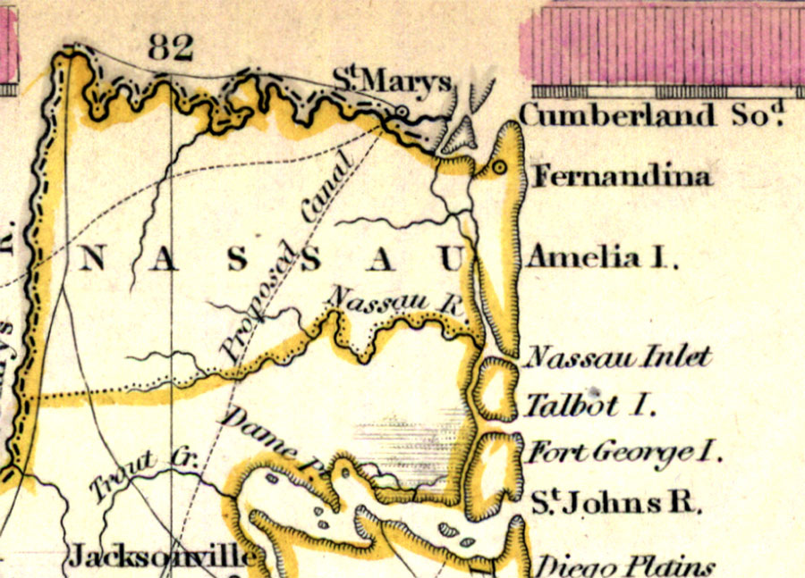
Boundaries: The shape of Nassau County looks different today than it did in 1824. The St. Marys and Nassau Rivers were always its northern, western, and southern boundaries. However, a set of conflicting descriptions of the land boundary between Duval and Nassau caused confusion at the onset of Nassau County’s existence. The original boundary was defined as a line heading east up the Nassau River to the Thomas Creek head waters, then running due west to the St. Marys River. This caused the areas of today’s Brandy Branch and Bryceville to fall on the Duval County side of the line. Yet, a second law passed in December of 1826, set the boundary from Thomas Creek headwaters southwestward to the headwaters of Big (Deep) Creek. This interpretation included not only today’s Brandy Branch and Bryceville, but Baldwin and small parts of today’s Baker County. The present day 45-degree
land boundary would not be officially defined until the 1850s.
County Seat: All counties need a single place for the government to conduct business and Nassau was no different. Fernandina was not the obvious choice at the beginning, as the port town was in deep decline since becoming an American possession. Fernandina, founded in 1825, was not the bustling international port and smuggling center it was just ten years prior. In January of 1827, the Florida legislature assigned Nassau County commissioners James Crozier, David Higginbotham, F D McDonnell, Elijah Higginbotham, and Lewis Bailey the task of locating the new courthouse site. The parameters were that it had to fall “west of a line running due south from Nathaniel Wilde’s landing and east of the Kings Road.” A year later, a centrally located site just south of the Little St. Marys River near today’s Evergreen was selected. A short waterway called the courthouse ditch was dug from the Little St. Marys River southward so timber could be floated to the site for construction of the log courthouse. Courts were established on the fourth Mondays in June and January. Nassau was paired with Duval County in the same militia district, in which units were called to duty twelve years later in 1836.
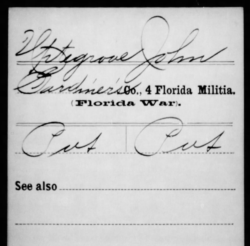
Call of duty, 1836: When Florida became a US territory, the American government forced the Seminoles living in the territory’s panhandle to move to a designated area in the center of the peninsular. However, in the 1830s, President Andrew Jackson demanded the Native Americans leave Florida altogether. In December of 1835, a band of Seminoles ambushed and killed over 100 soldiers marching from near Tampa to Fort King near Ocala. Shortly thereafter, the US Army began mustering members of several militias, including David Gardner’s 4th Regiment, 2nd Brigade Florida Militia which covered Duval and Nassau Counties. Captain David Gardner may be the namesake of Gardner Creek near the Hart’s Road Crossing of the Nassau River. Some Nassau soldiers included Adin Waterman, Reuben Hogans, and John Uptegrove, who lived on a Spanish Land grant west of Lofton Creek. John died within weeks of being called up for reasons unknown to the author at this time.
Slavery: Under Florida’s Second Spanish Rule (1783-1821), enslaved workers had rights to marry, own property, and to buy their freedom. They were not considered property as they were in the US states to the north. Many runaway slaves from the US sought refuge among the Seminoles living within the Spanish Florida boundaries. When Florida became a US possession, it became a slave territory. Those free African Americans not living with the Seminoles quickly left Florida. By 1830, there were 793 slaves and 46 Freed Blacks living in Nassau County, making up 55 percent of the county’s population. This ratio would roughly hold true for the next 90 years.
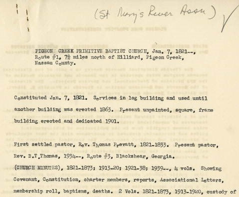
End of the band on Protestant Religions: During its second possession, Spain required settlers living in East Florida to be loyal to the Crown and to practice Catholicism. This requirement became harder to enforce as Spain’s influence over Florida weakened. When Florida became a US Possession, settlers were able to start churches that reflected their true faith. Florida’s first protestant church was founded in 1821 in Nassau County near today’s Boulogne. Pigeon Creek Primitive Baptist still meets today as a congregation, although the original building is long gone. Other churches founded in this time were Memorial Methodist in 1822 in Fernandina, New Hope Methodist in 1835 in O’Neil, and Bethany Primitive Baptist in 1839 near today’s Dyal.
John Hendricks is a Nassau County historian, author, and director of the West Nassau Historical Society. You can join him on the 4th Thursdays of each month at 6:30 pm at their meeting inside the historic Callahan Train Depot.


 RSS Feed